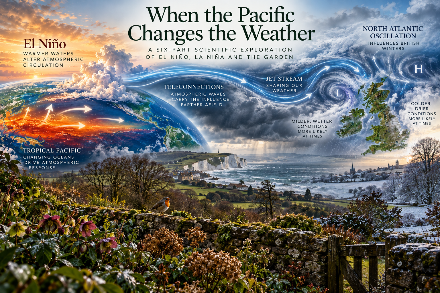
| Episode 3 What Does El Niño Actually Mean for Britain? |
| Somewhere in the tropical Pacific, thousands of miles from Britain, an enormous body of ocean water becomes warmer than usual. Trade winds weaken, tropical rainfall shifts and atmospheric circulation begins to change. Scientists recognise these developments as part of El Niño, one phase of the El Niño–Southern Oscillation, or ENSO. Back in Britain, a gardener looks out across a waterlogged lawn, watches another Atlantic depression approach or wonders whether the coming winter will bring hard frosts. It is tempting to connect these events, particularly when headlines suggest that El Niño could bring Britain a severe winter, prolonged rainfall or unusually mild conditions. But how much of Britain’s weather can genuinely be attributed to events in the Pacific? And perhaps more importantly, how confidently can scientists identify that influence before the weather actually happens? These questions bring us to one of the most fascinating, and frequently misunderstood, aspects of climate science. El Niño can influence British weather, but the relationship is indirect, variable and far from certain. Understanding why requires us to follow atmospheric changes from the tropics towards the North Atlantic, where several powerful climate systems compete to shape our seasons. An ocean thousands of miles away In our previous two episodes, we explored the physical relationship between the tropical Pacific Ocean and the atmosphere above it. We discovered how El Niño and La Niña alter ocean temperatures, trade winds, atmospheric pressure and tropical rainfall. These changes do not remain confined to the Pacific because the atmosphere is an interconnected system that constantly redistributes heat and momentum around the planet. When tropical rainfall shifts during El Niño, the associated release of heat into the atmosphere also changes location. This can disrupt large-scale atmospheric circulation and generate pressure and wind anomalies that extend far beyond the tropical Pacific. Scientists call these long-distance relationships teleconnections. The process is not comparable to a storm travelling directly from the Pacific to Britain. Instead, changes in tropical heating can influence atmospheric waves and circulation patterns across the Northern Hemisphere. Those changes may eventually affect the position and strength of the jet stream over the Atlantic, although the outcome depends upon the season and the wider state of the atmosphere. The effects therefore vary by region. Some regions, particularly around the tropical Pacific and parts of the Americas, have relatively well-established ENSO relationships. Britain’s connection is more complicated because the North Atlantic strongly influences our weather. This is where the scientific story becomes especially interesting. To understand how El Niño might influence Britain, we first need to understand what normally controls our weather. The Atlantic has the louder voice. Britain occupies a remarkable geographical position. We sit between the vast Atlantic Ocean and the European continent, at latitudes where tropical and polar air masses frequently interact. Our weather is therefore influenced by constantly changing atmospheric pressure patterns, prevailing winds and the movement of weather systems across the North Atlantic. One of the most important features is the jet stream, a relatively narrow region of powerful winds high in the atmosphere. It generally flows from west to east and helps steer the development and movement of Atlantic weather systems. When the jet stream is positioned so that successive depressions move towards Britain, we can experience prolonged unsettled conditions, sometimes accompanied by heavy rainfall and strong winds. When its position changes, or when persistent areas of high pressure interrupt the usual movement of weather systems, conditions can become much drier, calmer or colder. These differences are familiar to anyone who spends much of their working life outdoors. One winter may involve repeated visits to gardens where the ground never seems to dry. Another may bring prolonged frosts, cold easterly winds and surprisingly little rainfall. Both can occur without any simple explanation involving El Niño or La Niña. Much of this variability is associated with another atmospheric phenomenon: the North Atlantic Oscillation, or NAO. Britain’s own atmospheric seesaw The North Atlantic Oscillation describes variations in the atmospheric pressure difference between the subtropical Atlantic around the Azores and the northern Atlantic around Iceland. When that pressure difference is relatively big, the NAO is described as being in its positive phase. Westerly winds across the Atlantic tend to strengthen, often bringing milder, wetter and windier winter conditions to northern Europe, including Britain. When the pressure difference weakens or reverses, the NAO enters its negative phase. Westerly winds tend to weaken, allowing different atmospheric circulation patterns to develop. Britain may then experience a greater likelihood of cold northerly or easterly airflows, although the precise weather depends on where high- and low-pressure systems become established. The NAO is not simply another name for El Niño. It is a distinct pattern of atmospheric variability that can develop independently of conditions in the tropical Pacific. Nevertheless, ENSO can influence the probability of particular NAO conditions, especially during winter. And this is where the two systems begin to interact. An El Niño event may alter atmospheric circulation in ways that favour one North Atlantic pressure pattern over another. But the relationship is neither automatic nor consistent enough to determine Britain’s weather on its own. Other atmospheric processes can reinforce the influence, weaken it or overwhelm it altogether. Why the timing of winter matters One particularly interesting discovery is that El Niño’s influence on European winter weather can change as the season progresses. Research and Met Office guidance identify a tendency for El Niño to favour a more positive North Atlantic Oscillation during parts of early winter, increasing the likelihood of stronger westerly winds and unsettled conditions. Later in winter, however, the statistical relationship can shift towards a more negative NAO, associated with an increased chance of colder conditions in parts of northern Europe. This distinction matters because winter is not one continuous weather event. December and February can behave very differently, even though both belong to the same meteorological season. It also helps explain why apparently contradictory statements about El Niño and Britain can sometimes contain elements of scientific truth. One report may discuss an increased likelihood of mild, wet weather early in winter, while another highlights a possible tendency towards colder conditions later on. Neither relationship guarantees that the corresponding weather will occur. The strength of the El Niño event matters, as does the geographical pattern of Pacific warming. Other atmospheric influences can alter the response, and particularly strong events do not necessarily behave like weaker ones. The science therefore focuses on shifts in probability across many events, not a fixed sequence that must unfold during every individual winter. The atmosphere above the atmosphere Another possible route through which the tropical Pacific can influence European winters takes us much higher into the atmosphere. Above the troposphere, where most familiar weather occurs, lies the stratosphere. During Northern Hemisphere winter, powerful westerly winds circulate the Arctic within a large-scale feature known as the stratospheric polar vortex. The strength and behaviour of this circulation can influence weather patterns much farther below. When the vortex is disturbed, changes in the stratosphere can sometimes propagate downwards, affecting the jet stream and the distribution of atmospheric pressure across the North Atlantic. Research has shown that El Niño can alter atmospheric wave activity in ways that increase the likelihood of a weakened stratospheric polar vortex and, under some circumstances, sudden stratospheric warming events. A sudden stratospheric warming involves a rapid temperature increase in parts of the polar stratosphere, accompanied by substantial changes in its circulation. Some of these events are followed by atmospheric patterns that increase the likelihood of colder conditions in northern Europe. But this sequence is not inevitable. An El Niño does not guarantee a sudden stratospheric warming, and such warming does not guarantee snow or freezing weather in Britain. The connection matters because it shows how an influence originating in the tropical ocean can travel through several layers of atmospheric circulation before potentially affecting conditions much closer to home. It also illustrates why the relationship is so difficult to predict with certainty. When history refuses to repeat itself One of the most useful ways to test an apparent climate relationship is to examine what happened during previous events. If El Niño always produced the same British winter, the evidence would be straightforward. Every event would be followed by a recognisable pattern, and seasonal forecasting would become considerably easier. But history tells a more complicated story. The strong El Niño of 2015–16 coincided with an exceptionally wet and mild early winter in parts of Britain. Another strong event, during 2023–24, was also associated with a stormy start to the British winter. Yet these similarities do not mean all strong El Niño events produce the same result. Research into the 2023–24 winter found that the expected late-winter tendency towards a negative NAO did not clearly emerge. Instead, the observed late-winter NAO was close to neutral. That is a valuable scientific lesson. Even when an event develops familiarly, the atmospheric response can differ. Scientists investigate such examples to improve climate models and understand why particular teleconnections strengthen, weaken or fail to emerge. Evidence also suggests that ENSO can influence North Atlantic circulation during the following winter, after the original tropical Pacific event has weakened or ended. Research published by Met Office scientists in 2024 identified a delayed response that can differ in sign from the more immediate influence. The Pacific, it seems, can leave an atmospheric influence that extends beyond the event’s lifetime. But once again, that does not provide a dependable forecast for any individual British winter. What about La Niña? So far, we have concentrated mainly on El Niño, but La Niña also has potential implications for Britain. Because La Niña generally strengthens the normal tropical Pacific circulation rather than weakening it, its wider atmospheric influences can differ from those associated with El Niño. In some circumstances, La Niña can favour North Atlantic circulation patterns broadly opposite to those associated with El Niño. However, this relationship is not a perfect mirror image, and its effects vary with timing, strength and the interaction of other atmospheric systems. It would therefore be misleading to suggest that if El Niño increases the likelihood of one kind of winter, La Niña must automatically produce the opposite. The atmosphere contains too many interacting influences for such a simple reversal. Both phases of ENSO can provide useful information to seasonal forecasters, but neither should be treated as a reliable instruction manual for British weather. What seasonal forecasts can actually tell us? This brings us to an important distinction between forecasting tomorrow’s weather and assessing the likelihood of conditions several months ahead. A conventional weather forecast describes how atmospheric conditions will develop over a relatively short period. Seasonal forecasting asks a different question: are particular temperature, rainfall or circulation patterns more likely than usual over the coming months? Scientists use observations of the ocean and atmosphere, together with sophisticated computer models, to estimate these probabilities. ENSO is one factor they consider because tropical Pacific conditions can sometimes provide useful information about the likely evolution of the wider climate system. But the result is not a detailed forecast of every weather spell. A seasonal outlook suggesting an increased likelihood of wetter-than-average conditions does not mean it will rain continuously. Nor does an increased probability of a colder winter tell us whether a particular garden will experience snow, frost or prolonged freezing temperatures. Even a colder-than-average winter can include mild periods. A wetter-than-average season can include weeks without significant rainfall. This distinction matters because people naturally want certainty, especially when making practical decisions. Farmers, gardeners, transport operators and local authorities all have reasons to anticipate difficult conditions. Seasonal forecasts can help assess risks, but they cannot remove uncertainty. From national weather to the garden gate One further complication that gardeners understand particularly well is that Britain does not have a uniform climate. A winter that brings persistent Atlantic rainfall to western Scotland may produce very different conditions in eastern England. Coastal gardens experience different temperature extremes from sheltered inland valleys, while soil type, elevation and exposure can create substantial differences over surprisingly short distances. Even neighbouring gardens may respond differently to the same weather. Heavy clay soil can remain saturated long after rainfall has stopped, while free-draining sandy soil may become workable much sooner. A sheltered border may escape frost that damages plants in a nearby exposed position. This means there is a considerable distance between identifying a possible ENSO influence on British seasonal weather and understanding what that influence might mean for an individual garden. The relationship is not meaningless, but it becomes increasingly difficult to translate into specific local outcomes. This is especially relevant for professional gardeners. Looking after several properties means dealing with differences in drainage, exposure, soil condition and plant selection, even when every garden experiences broadly the same regional weather. Understanding ENSO can provide useful background knowledge, but decisions about individual gardens must still be based on local conditions and direct observation. Understanding influence without expecting certainty We began this episode with a simple question: what does El Niño actually mean for Britain? The scientific answer is that El Niño can alter the probability of certain atmospheric circulation patterns, particularly during winter, and those changes can influence the likelihood of particular temperature, rainfall and wind conditions. But ENSO is only one part of the explanation. The North Atlantic Oscillation, jet stream, stratospheric circulation and numerous other processes interact to determine what eventually happens. Britain’s distance from the tropical Pacific does not make us immune to ENSO’s influence. It simply means that the connection is filtered through a complicated atmospheric system, where other influences may be just as important or considerably stronger. Perhaps the most useful lesson is that understanding why a particular outcome becomes more likely is not the same as knowing that it will happen. That distinction is central to good climate science, and it matters just as much in gardening. We cannot look at an El Niño developing in the Pacific and confidently announce what the coming winter will bring to a garden in Kent. We can, however, understand why scientists pay attention to these distant ocean changes and how they shape seasonal risk assessments. Our journey has now taken us from the tropical Pacific, through the atmosphere and across the North Atlantic to Britain. But weather is only the beginning of the story. Rainfall, temperature, sunshine, drought and frost do more than shape our daily experience. Over time, they influence flowering, insect activity, breeding seasons, soil organisms and the delicate timing of life throughout the natural world. A change in weather patterns can change ecological conditions, sometimes with consequences that continue long after the original weather has passed. That’s where our exploration takes us next. Episode 4 — When Weather Becomes Ecology |
| Further Reading & Scientific Sources When the Pacific Changes the Weather — Episode 3 For readers who want to explore the science behind El Niño, La Niña, and their influence on British weather, the following resources provide further information from the Met Office and published scientific research. Met Office — Seasonal Forecasts and Climate Drivers Explains how large-scale climate patterns, including ENSO, contribute to seasonal forecasting and the assessment of weather probabilities. Met Office — North Atlantic Oscillation and UK Climate Explores the importance of North Atlantic atmospheric circulation in shaping Britain’s winter weather. Bell et al. — El Niño and European Winter Climate Peer-reviewed research examining how stratospheric changes can link tropical Pacific conditions to European winter circulation. Ineson et al. — Prediction of European Winter 2023/24 Investigates the challenges of predicting European winter conditions during a significant El Niño event. Met Office — Delayed ENSO Influences Research exploring how ENSO may affect North Atlantic atmospheric circulation beyond the winter in which an event occurs. A note on scientific interpretation: These sources describe statistical relationships and physical mechanisms, not guaranteed weather outcomes. El Niño and La Niña influence climate probabilities but do not determine Britain’s weather on their own. |
| About our writing & imagery Most articles are grounded in our real gardening experience, observations and reflections. AI may assist with research, drafting and editing, but the experiences, opinions and editorial direction are our own. Featured images may include our photography, original AI-generated visuals or, where stated, images credited to others. Earthly Comforts reviews and shapes all published content before publication. |

